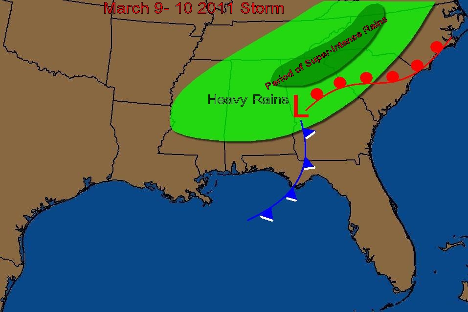
March is in full force. Every few years we get a storm like this. A strong trough will dig into the Southeast states the next two days, and deliver a powerful punch of dynamics across Tennessee, Georgia, Alabama and the Carolinas, before moving up the East Coast. This time,a couple of unique factors are added. The storm may cut off in the upper levels, and in addition just before the process is complete, a really rare set of circumstances are pointing to a quick, super-rain event in parts of Georgia and the Carolinas, near the spine of the Appalachians and Interstate 85 corridor. As the surface low is gearing up in Atlanta, the incoming energy in the lower Mississippi Valley will feed extreme divergence aloft and help to stall the initial rain bands over the western parts of the Carolinas and into Georgia. Normally rain systems move on eastward without much hesitation but if the models are right, the Atlanta Athens Spartanburg to Charlotte and Greensboro corridor are in for a period of perhaps extreme rainfall rates. This comes at a time right after a major rain event, so the fundamental rule for flood river forecasting is intensity, and most models are pointing toward an 6 hour period of some intense rain bands over this general area.
About early Thursday, the surface low under the negative tilt trough will form a triple point low, similar to the last event , near Greenville Spartanburg and that low will work toward central NC, and could be the catalalyst for a severe outbreak for the central and eastern Carolinas Thursday. On the backside, as the low closes off aloft, cold air will work in and rapidly change rain to snow in Asheville, Knoxville and the mountains of Tennessee, North Carolina and Kentucky and possibly even some flurries or snow showers into extreme Northern Alabama and Georgia. Accumulating snows are possible if the upper low is strong, for the Appalachians on Thursday into early Friday, but right now we're not sure exactly how the upper low will evolve exactly and that will make the difference on who gets how much snow. The heavy rains are a given though. Drive safe.


No comments:
Post a Comment