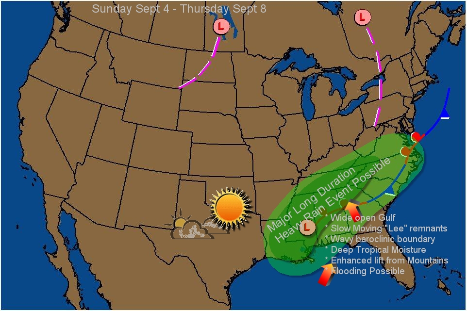
The unusual aspect of this storm is how it may interact with a decaying front, allowing a slow moving, long duration heavy rain event to unfold. Usually, the first part of the heavy rains occur on the western flank of the circulation, and where the front enhances convergence, and that means Sunday and Mondays heavy rains will occur in Louisiana, spreading into southeast Arkansas , western Tennessee and northern Mississippi and Alabama...but by later Monday that heavy rain will transfer quickly eastward to the front as its draped from central Tennessee , northern half of Alabama and northern GA and western Carolinas. If the front moves as slow as shown by the GFS and ECMWF, and the tropical depression remains in Alabama, that would place the mountains of Georgia and western NC in a true flood event, with possibly a foot of rain falling in a couple of days. But its still early and the models are just now latching on to the track of the system and how it interacts. Overall, an unusual setup. Normally, a tropical system comes inland and moves right along, but those few that don't, (like Alberto for example), extreme rain amounts can occur.
 |
| Heavy Rain potential Sunday through Most of next week. |


No comments:
Post a Comment